Sipaliwini Transects
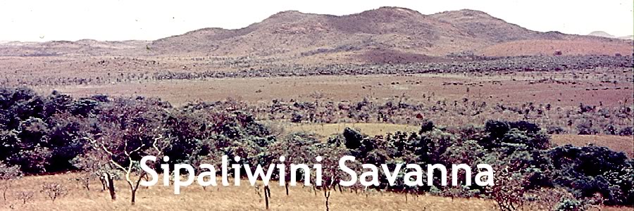
In this section we present some end results of our research on the vegetation of the Sipaliwini Savanna.
After having agreed upon the final description of our plant communities, we started to map the spatial distribution of the various vegetation types.
Since a detailed vegetation map of the savanna as a whole was beyond the scope of our field work, we selected 7 transects of one kilometre wide and varying in length between 3 and 11 kilometres. They represent most of the local land systems and vegetation types. For location and size of transects A – G see TRANSECTS, pg.1. (pdf, 2,8 MB)
Background information on geology, geomorphology, soils and savanisation (including various maps), please read TRANSECTS, pg. 2-10 (pdf, 2,8 MB). This article is based on Riezebos (1979): Geomorphology and soils of Sipaliwini Savanna (South Suriname). Hans Riezebos took part in the Sipaliwini expeditions 1968 – 1972.
Making vegetation maps of these transects turned out to be a lot of hard work, made easier by the availability of good quality aerial photographs (1:40,000) of the region.
To see a few examples please go to Transect Maps (pdf, 2,3 MB). A transect vegetation map (or part of it) is combined with an aerial photograph of the same area and on the same scale (1:10,000).
- Coloration and numbers are explained in an added Legend (pdf,108 kB). Please print this page if you like to study the transect maps in full detail
- Guidelines for interpretation are given in How to read the transect maps.
Transect A1 - D2
- Transect A1 (pdf, 184 kB)
- Transect A2 (pdf, 176 kB)
- Transect B1 (pdf, 192 kB)
- Transect B2 (pdf, 140 kB)
- Transect C (pdf, 184 kB)
- Transect D1 (pdf, 136 kB)
- Transect D2 (pdf, 164 kB)
